Sale on canvas prints! Use code ABCXYZ at checkout for a special discount!

Boundary: Bleed area may not be visible.

Inside Message (Optional)
Inside View

by CartographyAssociates
$4.95
Quantity
The more you buy... the more you save.
Orientation
Image Size
Product Details
Our greeting cards are 5" x 7" in size and are produced on digital offset printers using 100 lb. paper stock. Each card is coated with a UV protectant on the outside surface which produces a semi-gloss finish. The inside of each card has a matte white finish and can be customized with your own message up to 500 characters in length. Each card comes with a white envelope for mailing or gift giving.
Design Details
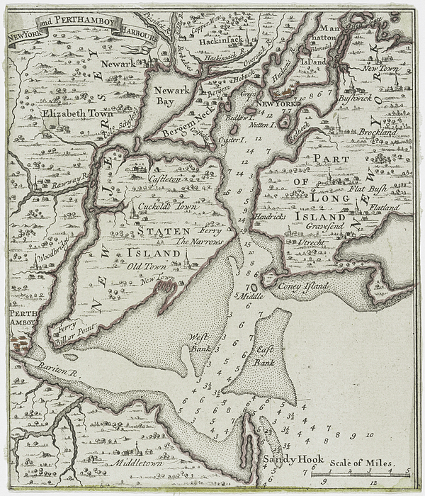
This is a vintage map of Staten Island and the New York City harbors. The map was originally produced in 1733.
Ships Within
2 - 3 business days
This is a vintage map of Staten Island and the New York City harbors. The map was originally produced in 1733.
Hello and Welcome! I'm Adam Shaw, CEO and found of Bravura Media Company. We're a company dedicated to delivering several forms of excellent digital content as well as goods and services. Our company has specializations in historical content, artwork, photography and video. Please take a look around our Fine Art America store and feel free to check out our YouTube Channel and Subscribe. Bravura Media Company YouTube channel: https://www.youtube.com/channel/UC0UypVUTqmjXBOwXwAKHdlg
$4.95


There are no comments for Vintage Staten Island and NYC Harbor Map - 1733. Click here to post the first comment.